I provide affordable, high-quality drone services for businesses and individuals. With expert piloting and advanced gear, I deliver sharp, stunning results—no matter the project.
Affordable mapping, 3D Modeling, Inspections, Surveys, and Aerial Photography
Aerial Photography & Cinematography
$100 per location
Capturing stunning visuals from above, I deliver high-resolution aerial photography and cinematic footage tailored for real estate, events, commercials, and more. Perfect for adding scale, impact, and perspective to any project.


Real Estate 3D/VR Tours
$500 per location
Immersive 3D and VR tours that bring real estate listings to life. Showcase properties with interactive, true-to-scale experiences that engage buyers and boost visibility.
Inspections & Surveys
Efficient aerial inspections and surveys for roofs, construction sites, utilities, and more. Get accurate data, high-resolution imagery, and safer assessments—faster and without the need for scaffolding or ladders.
Roof Inspection
$150–$400
Construction Progress Survey $250–$800+
Utility / Infrastructure Inspection $400–$1,200+
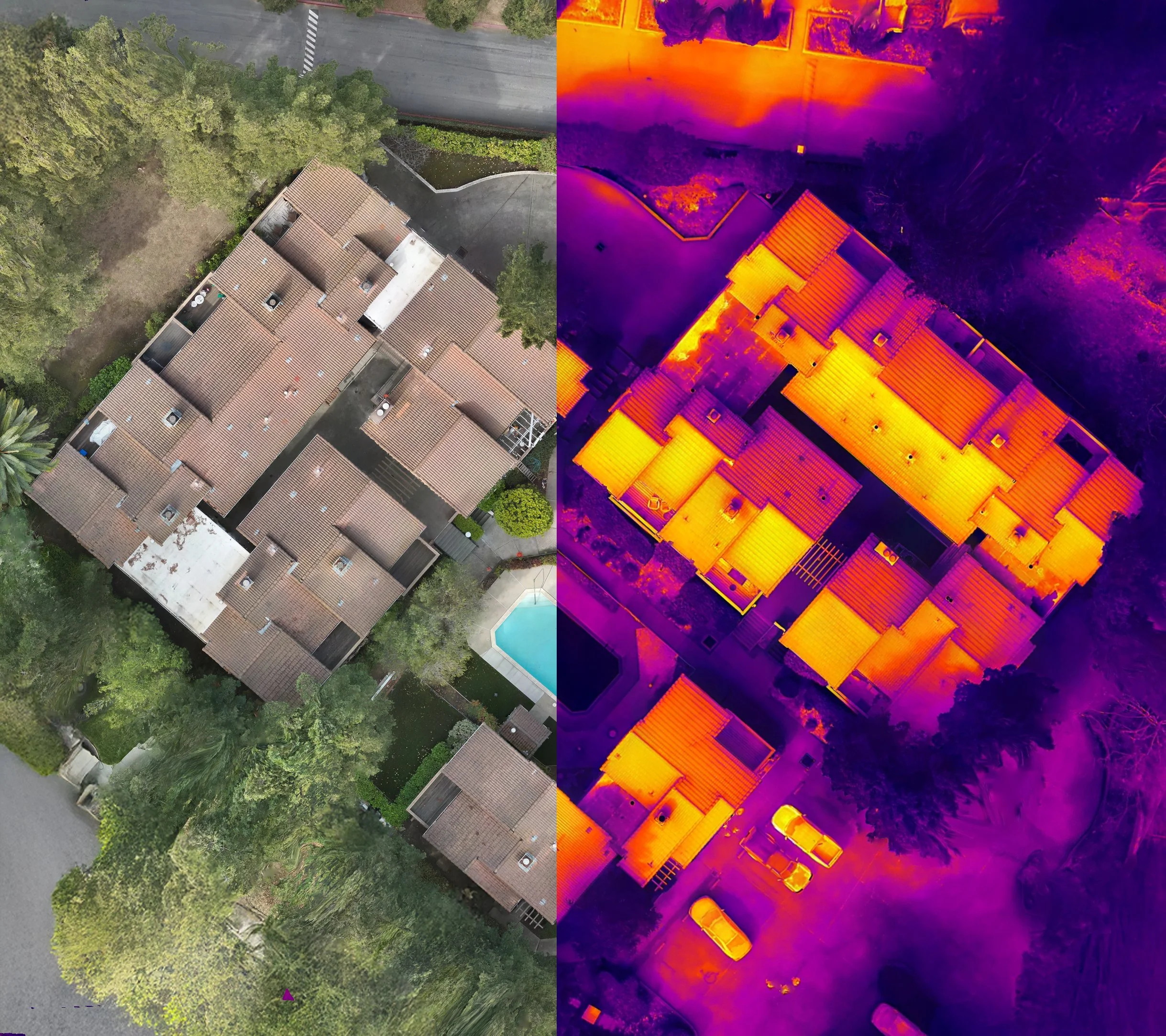
Thermal Inspections
$500–$1,500+
Mapping & 3D Modeling
High-precision mapping and 3D modeling services for construction, land development, and asset management. Capture detailed spatial data and visualizations to support smarter planning and decision-making.
Small site (<10 acres)
$100–$800
Medium site (10–50 acres)
$800–$1,500
Large site (50–200 acres)
$1,500–$3,500+